What is Cybertiks?
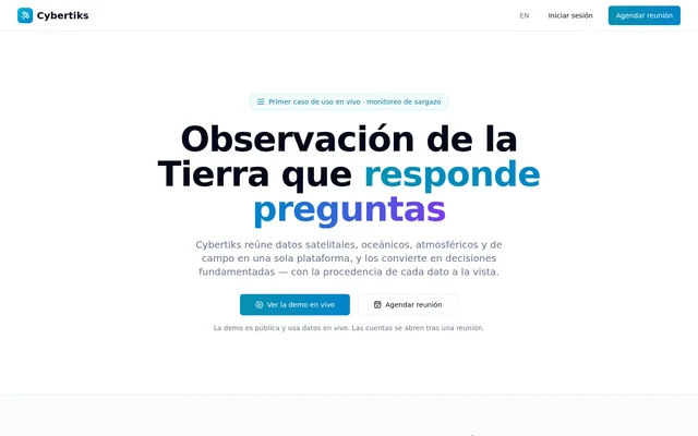
Cybertiks is an Earth observation platform for monitoring environmental phenomena through combined data and traceable analysis. Cybertiks brings satellite, oceanic, atmospheric and field information into a shared view intended to support operational decisions. The first live use case is sargassum monitoring, following the phenomenon from its source regions through ocean transport to coastal arrival.
Cybertiks is not tied to a single satellite or sector. The stated approach adapts monitoring to the phenomenon under observation rather than limiting analysis to imagery alone. Data provenance remains visible, allowing users to connect observations and calculated results to the sources and models behind them.
What Cybertiks can do
Cybertiks combines source collection, physical transport modelling and agent analysis. The analysis agent consults the sources needed for a question, reasons over the information and returns an actionable interpretation with citations. The monitoring approach also keeps observations dated and traceable so that evidence can support reports, claims or accountability.
- Cybertiks combines satellite data, environmental models, field sensors and operational records.
- Cybertiks uses winds and currents to model material transport.
- Cybertiks cites sources behind figures in agent-generated analysis.
- Cybertiks records dated observations with traceable provenance.
- Cybertiks reports station-level wind, current, waves and resulting drift over 72 hours.
- Cybertiks exposes model assumptions, including the wind drag coefficient.
How Cybertiks works
Cybertiks brings different data sources into a common analytical layer, then combines winds and currents in transport models to anticipate where material is heading. In the sargassum example, monitoring connects the Sargasso Sea, westward transport through the Great Atlantic Sargassum Belt and coastal arrival in the Mexican Caribbean.
Cybertiks offers a public monitor using live data. The example daily reading includes transport indicators for coastal movement, westward Atlantic transport and southward movement from the Sargasso Sea. Each station reports environmental conditions and resulting drift, while the source and calculation model behind each figure remain visible.
Who Cybertiks is for
Cybertiks serves operations that need to monitor environmental phenomena across defined areas of interest. The page focuses on sargassum as a connected process rather than an isolated coastal event. The stated applications include understanding movement toward shore and retaining evidence that can substantiate reporting, claims or accountability.
- Cybertiks supports monitoring sargassum from origin regions to affected beaches.
- Cybertiks supports examining transport toward the Mexican Caribbean coast.
- Cybertiks supports preparing reports backed by dated, traceable observations.
- Cybertiks supports monitoring configured around an operation's required data layers.
Cybertiks demo and account access
Cybertiks provides a public demo that uses live data, while account access follows a meeting rather than automatic registration. Account configuration is carried out collaboratively and covers areas of interest, alert frequency and the data layers required by the operation. The supplied page does not specify subscription prices or paid plan details.
Cybertiks strengths and limitations
Cybertiks emphasizes inspectable evidence: figures identify their sources and calculation models, and model assumptions are visible. Combining physical transport modelling with observations helps address where material may move, not just where it was observed. The public live-data demo also provides a way to examine the sargassum use case before an account meeting.
Cybertiks explicitly acknowledges limits in the available data rather than filling unknowns with estimates. Account access also requires a meeting and collaborative configuration, so there is no automatic registration path. Although the platform is described as adaptable to different phenomena, sargassum is the first live use case presented on the page.
Cybertiks FAQ
What is Cybertiks?
Cybertiks is an Earth observation platform that combines satellite, oceanic, atmospheric and field data for environmental monitoring. Cybertiks uses transport models and agent analysis to support decisions while keeping data sources, calculation models and observation provenance visible.
What can Cybertiks monitor?
Cybertiks is designed to adapt to different environmental phenomena rather than a single satellite or sector. The first live use case is sargassum, tracking origin regions, Atlantic transport and arrival on the Mexican Caribbean coast.
How does Cybertiks analyse sargassum movement?
Cybertiks combines winds and currents in transport models to anticipate material movement. The sargassum monitor follows transport from the Sargasso Sea through the Atlantic belt toward the Mexican Caribbean, with stations reporting wind, current, waves and resulting drift over 72 hours.
Can you try Cybertiks without an account?
Cybertiks provides a public demo using live data that can be viewed before an account meeting. Cybertiks opens accounts after a meeting and configures areas of interest, alert frequency and required data layers collaboratively rather than through automatic registration.
How does Cybertiks make its data traceable?
Cybertiks identifies the source and calculation model behind each figure and keeps observations dated and traceable. Cybertiks also exposes model assumptions, including the wind drag coefficient, and states when available data cannot answer a question.
From the community
No reviews yet
Be the first to review this tool. What you write helps the next person choose.